Animals of Australia: our lap around the country
One road trip, every region, and every animal we meet along the way, mapped and written up as we go.
What this project is
A lap around Australia is a rite of passage here. We’re using ours to build something that outlasts the trip.
In August 2026 we packed the car, threw a roof tent on top, and started a lap around Australia. Most people doing this road trip count sunsets and campsites. We’re counting animals.
Every stop, we record what we see. The birds picking through the campsite at dawn, the reptiles on the walking tracks, the rays in the shallows, the things that crash around outside the tent at night. Each sighting goes into a scientific log with a date, a location, and a photograph wherever we can manage one.
Then we write it up. Not a travel diary, but a proper field guide to the wildlife of that place, so the next person who camps there knows exactly what to look for and where. Cesar trained as a conservation biologist and has done fieldwork in Mexico, Sweden and Australia. That’s the standard we’re holding this to.
What actually lives here
Australia is one of only seventeen megadiverse countries on Earth, and most of what lives here lives nowhere else. Hover any photo for the species.
 ~400
Mammals
87% found only here
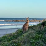
Eastern Grey Kangaroo joey
~400
Mammals
87% found only here
Eastern Grey Kangaroo joey
 ~900
Birds
45% found only here
Blue-winged Kookaburra
~900
Birds
45% found only here
Blue-winged Kookaburra
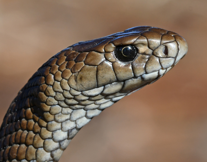 1,000+
Reptiles
93% found only here
Eastern Brown Snake
1,000+
Reptiles
93% found only here
Eastern Brown Snake
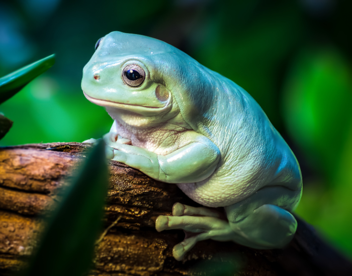 240+
Frogs
94% found only here
Australian Green Tree Frog
240+
Frogs
94% found only here
Australian Green Tree Frog
Australia holds more reptile species than any other country on Earth. Most Australians will never see a fraction of them.
We want to show people what’s actually out there, region by region, one campsite at a time.
Where we’re up to
These numbers are small right now. That’s the point — you’re watching this get built.
The map below fills in as we drive. A full lap around Australia takes most travellers a year; we’re taking our time, because we stop for weeks at a time to actually document a place properly rather than quickly moving on.
How we’re documenting the trip
Four steps, repeated at every stop. It’s the same process a field survey uses, scaled down to two people and a car.
Log every sighting
Species, scientific name, date, GPS coordinates, habitat and behaviour go into a Darwin Core spreadsheet — the same data standard museums and herbaria use.
Pin it to the route
Each confirmed sighting becomes a marker on the map below, clustered by campsite and joined by the route line. Click any animal to read about it.
Write the guide
Every location gets a full article covering what lives there, where to look, and what we actually saw — written from four or five days on the ground, not a search engine.
The map: everywhere we’ve been
Zoom in on a pin to see the individual animals recorded there. Click any animal to open its guide. The line traces our route around Australia so far.
Reading the map. Photo markers are campsites and stops. Click one to open its panel — the animals we logged there, its campground, and a link to the full wildlife guide.
Every stop so far
The written record behind each pin. This list grows with the map.
The next stop is being written now. We’re working north up the Queensland coast. New guides land here roughly every two to three weeks — subscribe below if you’d like them as they publish.
The route: Australia region by region
A clockwise lap that follows the seasons. South through the warmer months, then north and across the top in the dry. Each region gets its own set of wildlife guides.
- 01 Here now NSW North Coast, heading south to Sydney Subtropical coast and littoral rainforest: brushturkeys, bandicoots, coastal emus, white-bellied sea-eagles, stingrays in the shallows. Woody Head · Evans Head · Red Cliff · Illaroo · Pebbly Beach · Coffs Harbour · Nambucca Heads
- 02 Next Victoria and the south coast Cool-temperate forest and a colder coastline: little penguins, koalas, echidnas, fur seals along the Great Ocean Road. Wilsons Promontory · Phillip Island · Great Ocean Road · Grampians
- 03 Coming South Australia and the Nullarbor Southern right whales, Australian sea lions, wombats and the long empty crossing west. Eyre Peninsula · Head of Bight · Nullarbor Plain
- 04 Coming Southwest Western Australia A global biodiversity hotspot: quokkas, numbats, black cockatoos, karri forest and wildflower country. Esperance · Albany · Margaret River · Rottnest Island
- 05 Coming The Coral Coast Where the desert meets the reef: whale sharks, manta rays, nesting turtles, dolphins and dugongs. Kalbarri · Shark Bay · Coral Bay · Ningaloo
- 06 Coming Northern Western Australia Gorge country and red rock: rock wallabies, olive pythons, freshwater crocodiles, and some of the least-surveyed land in the country. Exmouth · Karijini · Broome · The Kimberley
- 07 Coming Northern Territory and Darwin Monsoon wetlands in the dry season: saltwater crocodiles, magpie geese, frilled lizards and huge waterbird congregations. Katherine · Litchfield · Kakadu · Darwin
From Darwin the loop closes back down through Queensland, with Tasmania and the Red Centre on the list too. Timings are deliberately loose. Weather, road closures and good wildlife all change the plan, and we would rather stay somewhere an extra fortnight than tick it off.
Questions about the project
The things people ask us at campsites.
What is a lap around Australia?
A “big lap” is a full circuit of the country by road, usually following Highway 1 around the coastline. That is roughly 15,000 km, or closer to 25,000 km once you add the detours worth taking. Most people do it in six to twelve months. It is the classic Australian road trip.
How often does the map get updated?
The map updates whenever a new location guide publishes, which is currently every two to three weeks. Sightings are logged daily in the field, but they only go on the map once the species identification is confirmed and the article is live.
How do you identify the animals?
Photographs first, then field guides, then cross-checking against verified records for that region. Anything we cannot confirm to species level stays off the map. Cesar’s background is in conservation biology, and uncertain records get flagged rather than guessed.
Can I use your sighting data?
Yes. Our records are submitted to iNaturalist and eBird, which feed into the Atlas of Living Australia, so they are publicly available there. Our written content is available under Creative Commons (CC BY-SA 3.0). Credit Wildlife Nomads and link back.
Where do you camp?
Mostly national park and state forest campgrounds, sleeping in a roof tent on the car. Those sites tend to sit inside the habitat rather than beside it, which is exactly why the wildlife lists are worth writing. Sometime hotels, sometimes we do house sits.
Are you doing the lap in one go?
No. We are doing it in stages over several years, spending weeks in each region rather than days. Slow travel produces far better records. Most of our best sightings came on the third or fourth morning somewhere, not the first.
New wildlife guide every few weeks
Straight from wherever we have parked. No spam, and you can leave whenever you like.
We send one email every few weeks. Unsubscribe any time.
Browse all wildlife guides